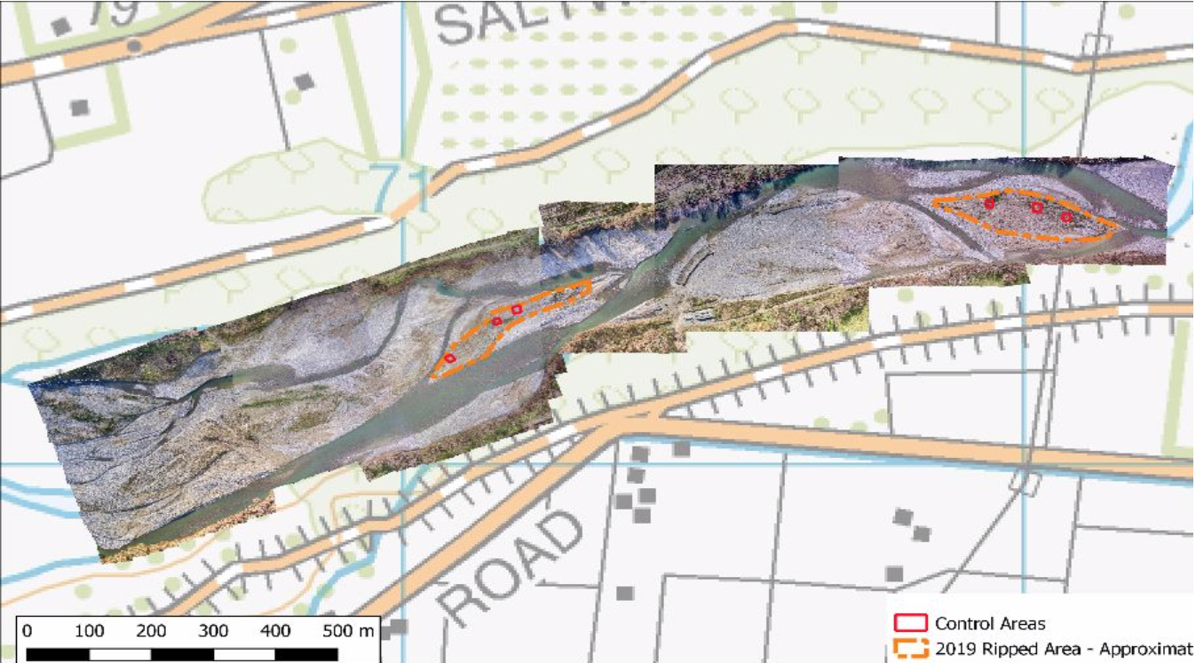
Ripping trial
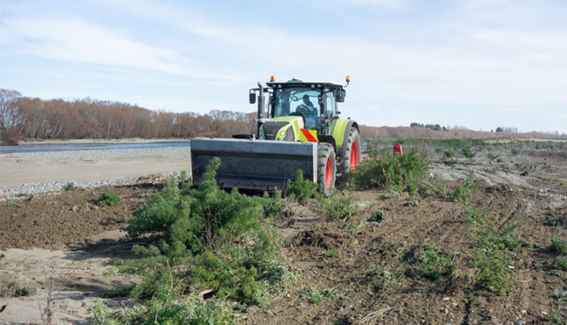
On Saturday, August 3, the ripping went ahead according to plan. Grant (tractor driver) and Nathan Stewart, plus his workshop worker came to start things off. The first rip was around the boundary, and the on-board GPS stated the area to be 1.7ha. Nick left after Grant had done about half of it in 1.25 hours, but he still had the toughest half to complete. Going through the densest vegetation and the most sandy/silty areas was not the easiest, and there was often a rapid build-up of debris in the ripper, which then had to be raised and emptied. The wet state of the ground caused by recent did not help. However, Grant knew what we wanted and re-did quite a few patches. The end result will be variable and not the best in places, but can readily be compared with the three 10x10m control plots which, Nick installed before they arrived. Despite the build-up of debris and the tractor being brought to a halt at times, the ripper itself appeared to survive intact.
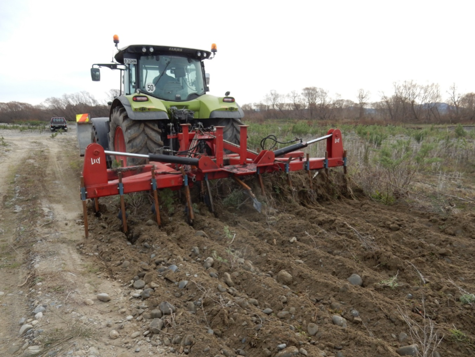
Four days later, (August 7), Grant Davey and Nick met up with Nathan and Grant the tractor driver down at the Tulls Island site to review progress to date. As stated above, the ground surface and vegetation on the island is very variable, ranging from open shingle and sand (deposited by the last flood) through light weed cover to closed-canopy lupins. The heavy lupin cover, often combined with deeper sand/silt, meant that the tractor had to work hard and the ripper often clogged up. Hence the weed removal was often not complete, although the end result was better than we expected. The overall job is certainly acceptable, with <5% of weeds estimated to survive; so the site will definitely be much easier to work next season. Due to the tractor having to work hard and often re-rip some areas, the cost was greater than expected – working out at around $240/hour. Hence, on the 1.7ha island, the total cost will be around $500. We have the budget to do more, and more is needed, not only to test different surfaces but also to prepare another site for Sanaz’s research. For these reasons, we arranged to meet TDG, about 1 km further up the river in the afternoon – between Tulls and Smarts.
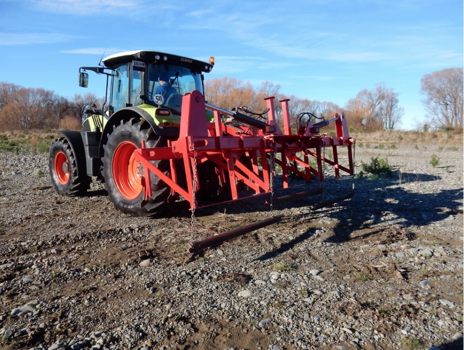
At 1 pm, Grant the tractor driver crossed the river to the middle section and started on an area of less than 2ha. Prior to his arrival, we marked out three more 10x10m control plots. The going here was variable but generally easier than down on Tulls island, although there were some patches of fairly deep sand/silt with larger lupins. The exact size of the area worked is still to be determined, but is likely to be under 2ha. It took around 2 hours to complete, but we had left before it was finished.
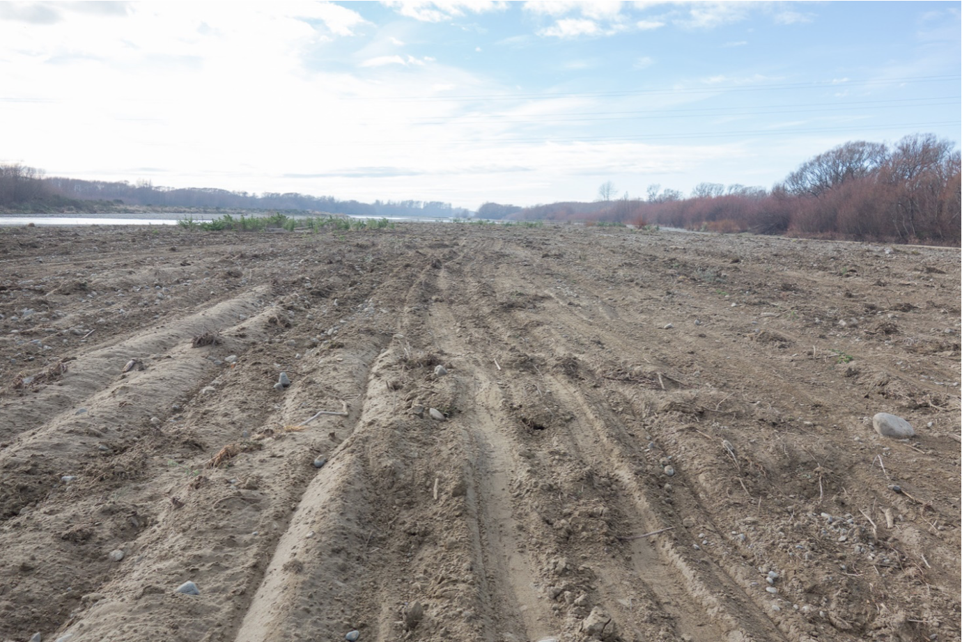
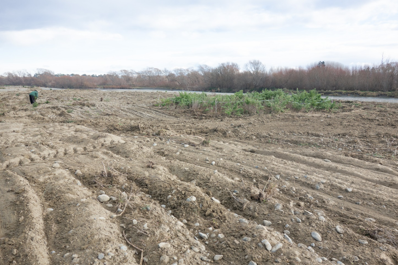
Grant is away for the next week, but when he returns we will spend another couple of hours completing the Tulls/Smarts area. For this operation, we will use the Mark 3 version of the ripper, with the tynes removed, as they do not appear to be adding anything extra, and probably contribute to the clogging up with vegetation. They have also been bent significantly. Having just the angled blade should do just as good a job (perhaps better) and should result in a better flow of material through the ripper ie., less clogging. There will also be heavier ‘smoothers’ towed behind the ripper, as they were too light before (and not present today), with the result being a more ribbed final surface. The ribbed surface probably traps fine sediment to some extent – and is thus undesirable.
Drone composite images were completed over the entire area between Smarts and Tulls prior to ripping. The areas ripped will be droned again soon. Drone photos were also taken of the first area to be ripped before the recent flood – comparison between the pre- and post-flood photos will be useful to see the flood effects.
